Publications
Machine learning for climate impact studies in the Ems catchment area
The use of machine learning models in climate impact studies remains largely unexplored. In this study, we analyze the Ems River catchment using a standard ensemble of climate projections from the German Weather Service. We compare the projected climate change signals from two conceptual hydrological models with those from two LSTM (Long Short-Term Memory) models. Based on long-term simulations, we assess the effects of climate change on various streamflow indices. The results reveal that projected changes in streamflow vary significantly depending on the model used and its specific input data. To apply LSTM models effectively in climate impact studies, it is essential to define physical constraints that ensure plausible watershed behavior under future climate conditions beyond the range of the training data.
Ley, A., Bormann, H., Casper, M. (2025): Climate change impact assessment on a German lowland river using long short-term memory and conceptual hydrological models. Journal of Hydrology: Regional Studies, 102426, https://doi.org/10.1016/j.ejrh.2025.102426.
Climate change impact assessment on a German lowland river using long short-term memory ...
Understanding Climate Change and Anthropogenic Impacts on Groundwater Salinization in the Weser-Ems Region
Seibert et al. (2024) study the impact of climate-change related factors on future groundwater salinities in the Weser-Ems region using variable density groundwater modeling. Separate model variants are constructed and forced with climate data (projected sea-level rise and groundwater recharge for RCP-2.6 und RCP-8.5) as well as likely ranges of other hydrogeological boundaries, including land subsidence, abstraction rates and drain levels.
Results show that elevated Geest areas will hardly be affected by groundwater salinization. Further, they show that autonomous salinization in the marsh areas, resulting from the slow reaction of groundwater to the current boundary conditions, is responsible for >50% of the salinization increase until 2100 CE. Climate change accelerates salinization, whereby sea‐level rise is the dominating factor causing salinisation near the coast and the rivers.
The „worst-case“ scenario (RCP-8.5, 95%-percentile) caused the most severe salinization with a freshwater volume decrease of ~10% in the marsh until 2100. Besides sea-level rise, land subsidence caused by mineralisation of organic soils and drain levels are the other major factors controlling salinization in the marsh while groundwater abstraction and recharge changes seemingly have more local effects. Regional‐scale uplifting of drain levels is identified as an efficient measure to counteract salinization.
Seibert, S.L., Greskowiak, J., Oude Essink, G.H.P., & Massmann, G. (2024): Understanding climate change and anthropogenic impacts on the salinization of low-lying coastal groundwater systems. Earth's Future, 12, e2024EF004737, doi:10.1029/2024EF004737
Understanding climate change and anthropogenic impacts on the salinization ...
Rather with than About - Reshaping Qualitative Empirical Research Methods in Times of Physical Distancing
The implementation of the first phase of the WAKOS project was also affected by the COVID pandemic. How the pandemic and physical distancing affected transdisciplinary research activities and how they need to be redesigned was examined in a publication in the International Journal of Qualitative Methods. Our analysis showed that video-based formats in qualitative research are sufficient to gather information. However, the content level is hardly exceeded and decisive processes of relationship and trust building only take place to a limited extent. Compared to face-to-face formats, the use of video-based formats limits non-verbal communication, emplacement and trust-building. This has problematic consequences for data generation and analysis as well as for interaction in the sense of long-term relationship building, knowledge generation and a sense of responsibility. In short: Digital formats harbor the risk that research is conducted about participants and not together with participants.
Karrasch, L., Schoppe, A., Wessels, A., Schulte-Güstenberg, E., Döring, M., & Ratter, B. (2024): Rather with than About - Reshaping Qualitative Empirical Research Methods in Times of Physical Distancing. International Journal of Qualitative Methods, 23, doi:10.1177/16094069241266191
Rather with than About - Reshaping Qualitative Empirical Research Methods ...
Risks behind the dykes - dealing with coastal compound events as a transdisciplinary challenge
Climate change adaptation is not a purely technical process, but also a socio-cultural and institutional one. The challenges of the changing risk situation lie among others in the more frequent occurrence of compound events. Raising awareness of these developments among decision-makers and those affected is key to prevention through appropriate measures and their implementation before the next extreme situation occurs.
Ratter, B., Anke Wessels, A., Bormann, H., & Weisse, R. (2024): Risikoregion hinter den Deichen - Umgang mit Extremereignisbündeln als transdisziplinäre Herausforderung an der Küste. In: RaumPlanung 227 / 3/4-2024, S. 13-18
Risk of flooding in coastal areas due to the combination of storm surge and precipitation events
In addition to storm surges, inland flooding due to intense rainfall becomes an increasing threat at coastal lowlands. In particular, the coincidence of both types of events poses great challenges to regional water boards since their technical drainage capacities are limited. The work published in Natural Hazards and Earth System Sciences shows that during compound events, even relatively moderate values of the individual drivers may cause large impacts due to their co-occurrence.
Bormann, H., Kebschull, J., Gaslikova, L., & Weisse, R. (2024): Model-Based Assessment of Climate Change Impact on Inland Flood Risk at the German North Sea Coast Caused by Compounding Storm Tide and Precipitation Events. Natural Hazards and Earth System Sciences 24 (7), 2559–76, doi:10.5194/nhess-24-2559-2024
Model Based Assessment of Climate Change impact ...
Removing dynamic sea-level influences from groundwater-level measurements
The sustainability of limited freshwater resources in coastal settings requires an understanding of the processes that affect them. This is especially relevant for freshwater lenses of oceanic islands. Yet, these processes are often obscured by dynamic oceanic water levels that change over a range of timescales. We use regression deconvolution to estimate an oceanic response function (ORF) that accounts for how sea-level fluctuations affect measured groundwater levels, thus providing a clearer understanding of recharge and withdrawal processes. The method is demonstrated using sea-level and groundwater-level measurements on the island of Norderney in the North Sea (northwestern Germany). We expect that the method is suitable for any coastal groundwater system where it is important to understand processes that affect freshwater lenses or other coastal freshwater resources.
Haehnel, P., Rasmussen, T.C., & Rau, G.C. (2024): Technical note: Removing dynamic sea-level influences from groundwater-level measurements. Hydrology and Earth System Sciences, 28(12), 2767-2784, doi:10.5194/hess-28-2767-2024
Technical note: Removing dynamic sea-level influences ...
Improving seasonal predictions of German Bight storm activity
Extratropical storms are one of the major coastal hazards along the coastline of the German Bight, the southeastern part of the North Sea, and a major driver of coastal protection efforts. However, the predictability of these regional extreme events on a seasonal scale is still limited. We improved the seasonal prediction skill of a large-ensemble decadal hindcast system for German Bight storm activity (GBSA) in winter for both, deterministic and probabilistic predictions. To improve the skill, we used the state of two physical predictors of GBSA activity and translated the state of these predictors into a first guess of GBSA. We removed ensemble members with a GBSA prediction too far away from this first guess. The resulting subselected ensemble exhibits a significantly improved skill for both deterministic and probabilistic predictions of winter GBSA.
Krieger, D., Brune, S., Baehr, J., & Weisse, R. (2024): Improving seasonal predictions of German Bight storm activity. NHESS, 24, 1539–1554, doi:10.5194/nhess-24-1539-2024
Improving seasonal predictions of German Bight storm activity
Climate change impact on barrier island freshwater lenses
Freshwater lenses and their brackish water zones are influenced by climate change through sea level rise and future changes in groundwater recharge. Changes in freshwater volume, freshwater lens depth, and brackish water zone thickness by the end of the century were investigated using a generic island cross-section together with sea level rise, ground water recharge, and climate change projections derived from different climate models and climate change scenarios for the island of Norderney.
Thissen, L., Greskowiak, J., Gaslikova, L., & Massmann, G. (2024): Climate change impact on barrier island freshwater lenses and their transition zones: a multi-parameter study. Hydrogeology Journal, doi:10.1007/s10040-024-02800-3
Climate change impact on barrier island freshwater lenses ...
Weather conditions that cause high headwater discharges and storm surges to occur together will become more frequent in the future
The authors developed a machine learning approach for the classification of Großwetterlagen and analyzed changes in the occurrence of Cyclonic Westerly responsible for the majority of compound flood events in northern and central Europe as projected by 31 CMIP6 models under the emission scenarios SSP1-2.6, SSP3-7.0, and SSP5-8. They found a robust increase in the frequency of Cyclonic Westerly days during the main storm surge season in winter. This indicates a higher probability for the future occurrence of compound flood events in northern and central Europe.
Heinrich, P., Hagemann, S., & R. Weisse (2024): Automated classification of atmospheric circulation types for compound flood risk assessment: CMIP6 model analysis utilising a deep learning ensemble. Theor. Appl. Climatol., submitted, preprint, doi:10.21203/rs.3.rs-4017900/v1
Automated classification of atmospheric circulation types ...
Joint occurrence of high headwater discharge and storm surges in climate change
As part of his doctoral thesis at the Helmholtz-Zentrum Hereon, Philipp Heinrich investigated how the co-occurrence of storm surges with high river runoffs can change in a changing climate. He used data from two emission scenarios and two different models. Based on this data, the work concludes that the future increase in flood events across Europe is mainly due to the rise in mean sea level, but that a contribution is also due to changes in river discharge.
Heinrich, P., Hagemann, S., Weisse, R., & Gaslikova, L. (2023): Changes in Compound Flood Event Frequency in Northern and Central Europe under Climate Change. Front. Clim., 5, 1227613, doi:10.3389/fclim.2023.1227613
Changes in Compound Flood Event Frequency ...
Simulation of the effects of climate change on groundwater recharge on the island of Norderney
The availability of freshwater on the barrier islands in the North Sea depends primarily on extractions from their freshwater lens below the island when no pipeline to the mainland exists. Forward-looking management of freshwater resources therefore requires future projections that take into account the effects of climate change on groundwater recharge.
In the publication by Ley. et al. (2023), the effects of climate change on groundwater recharge on Norderney are simulated based on a small ensemble of high-resolution climate projections. The uncertainties caused by the climate model and the bias correction are compared with the magnitude of the climate change effects.
Ley, A., Haehnel, P., & Bormann, H. (2023): Addressing the challenges of climate scenario-based impact studies in modelling groundwater recharge on small barrier islands at the German North Sea coast. Journal of Hydrology: Regional Studies, Volume 50, 101578, ISSN 2214-5818, doi:10.1016/j.ejrh.2023.101578
Addressing the challenges of climate scenario-based impact studies ...
Phase-averaged tidal boundary condition for groundwater flow models
Due to the fluctuation of the sea level over a tidal cycle, the groundwater surface in coastal aquifers is raised above the level of the mean sea level. To represent this in groundwater flow models, a high temporal resolution is often used, which explicitly simulates each tidal cycle. For large models, e.g. of entire islands, this approach is not practicable due to high computing times.
In the publication by Haehnel et al. (2023), an approach is presented to represent this effect of the tides on the groundwater as a phase mean (mean over a tidal cycle). This significantly reduces the calculation times compared to the previous approach and makes it possible to take this effect into account even in spatially extended models. As part of WAKOS, this will be used in the simulations of the climate scenarios for the freshwater lens of the island of Norderney.
Haehnel, P., Greskowiak, J., Robinson, C. E., Schuett, M., & Massmann, G. (2023): Efficient representation of transient tidal overheight in a coastal groundwater flow model using a phase-averaged tidal boundary condition. Advances in Water Resources, 181, 104538, doi:10.1016/j.advwatres.2023.104538
Efficient representation of transient tidal overheight ...
Hydrogeological structural model for the island of Norderney
To develop groundwater flow models, structural models are required that describe the hydrogeologically relevant geological units in the study area. The development of such a hydrogeological structural model for the island of Norderney is presented in the publication by Haehnel et al. (2023) in the ‘Geoscience Data Journal’. This structural model forms the basis for modeling the freshwater lens of Norderney with regard to possible influences of climate change on the island's freshwater resources.
Haehnel, P., Freund, H., Greskowiak, J., & Massmann, G. (2023): Development of a three-dimensional hydrogeological model for the island of Norderney (Germany) using GemPy. Geoscience Data Journal, 00, 1-17, doi:10.1002/gdj3.208
Development of a three-dimensional hydrogeological model ...
Comparison of different machine learning approaches with a classic hydrological model
Machine learning approaches are being used more and more frequently in hydrology. However, it is still unclear to what extent such approaches can ‘only’ reproduce the discharge hydrograph of a catchment area or also map the underlying process understanding. The latter is crucial for successful application in climate impact assessment, for example.
For the Ems catchment area, Alexander Ley is comparing various machine learning approaches with a classic hydrological catchment model in terms of their ability to map both statistical quality measures and the frequency distribution of runoff. His further work aims to carry out comparative climate impact assessments for the Ems discharge using the different model types to derive statements about the extrapolability of machine learning approaches.
Ley, A., Bormann, H., & Casper, M. (2023): Intercomparing LSTM and RNN to a Conceptual Hydrological Model for a Low-Land River with a Focus on the Flow Duration Curve. Water 2023, 15, 505, doi:10.3390/w15030505
Intercomparing LSTM and RNN to a Conceptual Hydrological Model ...
Joint occurrence of high headwater discharge and storm surges in climate change
As part of his doctoral thesis at the Helmholtz-Zentrum Hereon, Philipp Heinrich investigated how the co-occurrence of storm surges with high river runoffs can change in a changing climate. He used data from two emission scenarios and two different models. Based on this data, the work concludes that the future increase in flood events across Europe is mainly due to the rise in mean sea level, but that a contribution is also due to changes in river discharge.
Heinrich, P., Hagemann, S., Weisse, R., Schrum, C., Daewel, U., & Gaslikova, L. (2023): Compound flood events: analysing the joint occurrence of extreme river discharge events and storm surges in northern and central Europe. Nat. Hazards Earth Syst. Sci., 23, 1967–1985, doi:10.5194/nhess-23-1967-2023
Compound flood events: analysing the joint occurrence ...
Volume changes of freshwater lenses on islands
Freshwater lenses are an important freshwater resource on islands worldwide. In WAKOS, the volume changes in freshwater lenses that can be expected as a result of climate change are analyzed using generic models to allow generally valid statements to be made for a large number of islands. In the study published by Thiessen et al. (2023) in the journal ‘Groundwater’, a method is described in preparation for the climate simulations with which the volume of freshwater lenses can be estimated with the help of the island shape or the so-called ‘circularity’.
Thissen, L., Greskowiak, J. & Massmann, G. (2023): Estimating Freshwater Lens Volume Based on Island Circularity. Groundwater.
Estimating Freshwater Lens Volume Based on Island Circularity
Decadal prediction of German Bight storm activity
While periods up to the end of this century are often considered when analyzing climate change, shorter periods of months to a few years often play a role for practical purposes. As part of WAKOS, Daniel Krieger from the Helmholtz Centre Hereon has shown that storm activity over the German Bight can be successfully predicted to a certain extent using the Max Planck Institute for Meteorology's decadal hindcast system.
Krieger, D., Brune, S., Pieper, P., Weisse, R., & Baehr, J. (2022): Skillful decadal prediction of German Bight storm activity. Nat. Hazards Earth Syst. Sci., 22, 3993–4009, doi:10.5194/nhess-22-3993-2022
Skillful decadal prediction of German Bight storm activity
Publication in the journal "Wasser und Abfall"
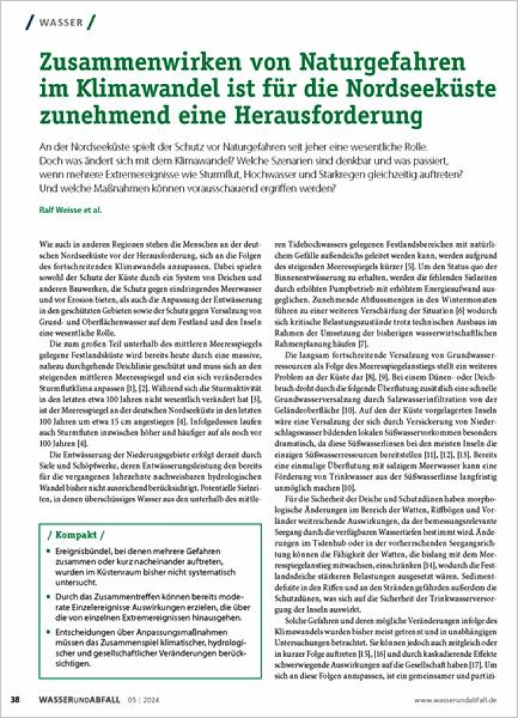
Changes in the area of tidal flats, reef bends and forelands have far-reaching effects, as the design-relevant sea state is determined by the available water depths. Lowland areas are currently drained by tide gates and pumping stations, whose drainage capacity does not yet adequately take into account the hydrological changes that have already been observed in recent decades. The slowly progressing salinisation of groundwater resources as a result of sea level rise represents a further problem on the coast. WAKOS analyzed the occurrence of compound events in which several of these hazards occur together or in quick succession. Due to the co-occurrence, even moderate individual events can have effects that go beyond those of individual extreme events. Decisions on adaptation measures must therefore take into account the interplay of climatic, hydrological, and societal changes.
Weisse, R., Gaslikova, L., Hagemann, S., Heinrich, P., Berkenbrink, C., Chen, J.J., Bormann, H., Kebschull, J., Ley, A., Massmann, G., Greskowiak, J., Thissen, L., Karrasch, L., Schoppe, A., Ratter, B.M.W., & Wessels, A.. (2024): Zusammenwirken von Naturgefahren im Klimawandel ist für die Nordseeküste zunehmend eine Herausforderung. Wasser und Abfall 26 (5), 38–45, doi:10.1007/s35152-024-1854-y
Zusammenwirken von Naturgefahren im Klimawandel ...
Publication in the journal "Bevölkerungsschutz und Katastrophenhilfe"
WAKOS brings together fragmented knowledge on climate impacts and climate adaptation and fills information gaps for the northwest German coastal region. It creates information bases for spatial planning and disaster risk management. Scenario-based maps of flood risk in the coastal lowlands can contribute to evacuation planning, the assessment of the vulnerability of critical infrastructure, and supply planning. Management options for floods (e.g. targeted flood relief) can thus be formulated for the scenarios under consideration before an event occurs and the need for action can be identified (e.g. emergency power supply in the event of a disaster). In the long term, strategic planning processes in the municipalities are also supported.
Bormann, H., Berkenbrink, C., Karrasch, L., Massmann, G., Ratter, B., Wessels, A., & Weisse, R. (2024): Wasser an den Küsten Ostfrieslands (WAKOS): maßgeschneiderte Klimaservices für die Anpassung. Notfallvorsorge 1/2024, S. 17-25
Synthesis papers from the RegIKlim working groups published
The RegIKlim working groups, in which employees from the RegIKlim model regions regularly exchange views on specific topics, have produced helpful guidelines on how to approach various challenges in climate adaptation. Employees from the WAKOS project have also contributed to these guidelines and incorporated their expertise and experience from the project.
In the RegIKlim working group Integrated assessment at regional and municipal level, different approaches to the assessment of adaptation measures were compiled and, as a result, a catalog of questions was compiled that can be used as a guideline in the preparation of the assessment of adaptation measures. From WAKOS, the process of vision development was presented in more detail as a procedure for the cooperative development of assessment goals. The guidelines are primarily intended to support local decision-makers in the evaluation and prioritization of climate adaptation measures, who are faced with the challenge of evaluating and selecting suitable options for action with the available resources.
Klimaanpassungsmaßnahmen bewerten – Herausforderungen und Lösungsansätze aus der Praxis
A cross-model-region working group was also set up for the subject-specific exchange on Regional adaptation capacities and adaptation needs. The resulting guideline presents common concepts for recording and assessing adaptation capacities and offers insight into the methodological diversity of the approaches used in RegIKlim. The guide offers scientists and practitioners a quick introduction to the topic and presents basic methodological starting points for analyses. WAKOS is presented as a practical example of analyzing collaborative adaptive capacity using a qualitative network perspective.
Erfassung und Bewertung von Anpassungskapazität - Ansätze aus der RegIKlim Forschung
The exchange between the model regions within the RegIKlim working group Transdisciplinary Processes was also documented in the form of guidelines that other transdisciplinary climate adaptation research projects can use for orientation. These guidelines aim to highlight experiences in transdisciplinary research in RegIKlim to guide follow-up projects in effectively building up regional climate knowledge through transdisciplinary approaches and thereby supporting climate action. For the WAKOS project, the fruitful cooperation with regional and local stakeholders from East Frisia was presented as part of the research work.
Transdisziplinäre Forschung in der regionalen Klimaanpassung - Erfahrungen aus der Fördermaßnahme RegIKlim
The RegIKlim working group Transferability and Transfer has developed a concept for the operational continuation and scaling of climate services as a central product of the collaboration, which incorporates the experiences from the model regions. The concept is intended to support applied adaptation research in successfully transferring research results in the project regions and developing an approach for scaling results and tools in other regions. The RegIKlim research networks, including WAKOS, are both addressees of this concept and examples of transfer and scaling activities.
Konzept zur operativen Verstetigung und Skalierung von Klimadiensten - Praktische Erfahrungen aus der Fördermaßnahme RegIKlim
Effect of compound events on inland flood events in the coastal lowlands
Inland flooding events pose an increasingly serious threat to coastal lowlands. In particular, the combination of storm surges and heavy rainfall poses major challenges for drainage systems. This article examines the extent to which climate model calculations for East Frisia include such compound events and the extent to which their impact on inland drainage will intensify in the future.
Bormann, H., & Kebschull, J. (2023): Wirkung von Ereignisbündeln (Compound events) auf Binnenhochwasserereignisse in den Küstenniederungen. In: Heft 44 2023 Forum für Hydrologie und Wasserbewirtschaftung, Nachhaltiges Wassermanagement - Regionale und Globale Strategien, Session 1: Monitoring und Analyse hydrologischer Extreme, S. 5-14
Heft 44 2023 Forum für Hydrologie und Wasserbewirtschaftung
RegIKlim recommendation paper - Strengthening climate adaptation at municipal and regional level
The project coordinators of the RegIKlim funding programme want to strengthen municipalities and regions in Germany in their ability to act on climate change through application-oriented research. In an iterative process, RegIKlim jointly developed key recommendations on how research and public administration can work together to achieve this goal. We further developed these recommendations with practitioners in various workshop and discussion formats (RegIKlim Status Conference 2022, AR6 Discussion Event of the German IPCC Coordination Centre 2022, KAHR Science Conference 2022).
The recommendations aimed at representatives of public administration at local, federal, and state levels to show how adaptation research can be used to implement measures. They further aim at research institutions and research funding organizations to outline ways for the effective further development of adaptation research.
Bernhofer, C., Birkmann, J., Braun, M., Cortekar, J., Garschagen, M., Göttsche, F., Heidenreich, M., Hildmann, C., Mahrenholz, P., McMillan, J., Pinto, J., Sieck, K., von Streit, A., Weber, F.-A., Weisse, R., Wessels, A., & Zimmermann. B. (2022): Empfehlungspapier Klimaanpassung auf kommunaler und regionaler Ebene stärken.
Download the RegIKlim recommendation paper

